CLICK_ON_THE_IMAGE_TO_ENLARGE
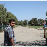
I am not sure, the name of this bridge is Munduchira. It lies in the north eastern area of the village. It lies in the bus route to Nedungad Island. On a rainy Sunday, I was just wandering alone through some roads of nayarambalam which was quite unfamilier to me. I started from my home, walked to the panchayat road to Nayarambalm Bhagavathy temple, and walked straight along towards Thyezhuthuvazhi. Then crossed Kappuchira bridge, walked again aside the public cemetry, and finally get into the Aniyil Jn through Munduchira bridge... It took more than 2 hours. I was too slow. But it was a good experience. Walking in rain through some unfamilier village roads...
Nayarambalam is a coastal village on Vypeen island in Ernakulam District in the state of Kerala, India. The village is surrounded by Edavanakkad Grama Panchayat to the north, Narakkal Grama Panchayat to the south, the Arabian Sea to the west and Veeranpuzha to the east. This blog is a photographic documentation of Nayarambalam.
Friday, November 30, 2007
Public cemetery , Nayarambalam
CLICK_ON_THE_IMAGE_TO_ENLARGE
This is the public cemetery here in Nayarambalam. Located at the north eastern boundary of the village.
Labels:
public place
Wednesday, March 14, 2007
Link to geocities.
Lots of downloads available at http://www.geocities.com/nayarambalam/
There were lots of stuff available at geocities. But unfortunately, the service was discontinued in 2009. Could not recover the data before I lost access to it. :-(
Labels:
Off topic
Tuesday, March 13, 2007
Map of Nayarambalam
This is the first version of not-to-scale map of Nayarambalam grama panchayat. Compiled with the help of Mr. N.A. Jain (4th Ward Member). More accurate version will be uploaded later. Those who want to get pdf version please click on this link
Labels:
Demographic Details,
Map
Wednesday, February 21, 2007
About Nayarambalam
Nayarambalam is a coastal village in Ernakulam District, kerala, India. It is surrounded by Edavanakkad Grama Panchayath in the North, Narakkal Grama Panchayath in the South, Arabian Sea in the West and Veeranpuzha in the east. Nayarambalam lies at almost in the center of Vypeen Island. Agriculture and fishing was the main income source of the people in the olden times. But now most of the people depends Cochin City - the nearest City in Main Land. Still there are lots of paddy fields and fish ponds especially in the Eastern and Western area of the village. The famous festivals of Nayarambalam include the temple festivals of Bhagavathi Temple and Kochambalam Subrahmanya Temple. Many Christian churches and mosques are also located there.
For more reading just read the page I have edited in wikipedia:
http://en.wikipedia.org/wiki/Nayarambalam
For more reading just read the page I have edited in wikipedia:
http://en.wikipedia.org/wiki/Nayarambalam
Monday, February 12, 2007
Thursday, February 01, 2007
DEMOGRAPHIC PARTICULARS OF NAYARAMBALAM
This details are taken from official website of Kerala Govt.
• Area in sq.Km. : 12.19 • No of Wards : 10 • Occupied Residential houses : 4240 • No of house holds : 4240 • Male population : 11313 • Female population : 11853 • Total population : 23166 • Density of population per sq.km : 1783 • Sex ratio (Females per 1000 males) : 1047 • Effective Literacy Rate [Male] : 97.26 • Effective Literacy Rate [Female] : 92.26 • Effective Literacy Rate [Total] : 94.69
* Based on Department of Economics & Statistics, Kerala [Panchayat Level Statistics 2001, Eranakulam District]
Labels:
Demographic Details
Subscribe to:
Posts (Atom)